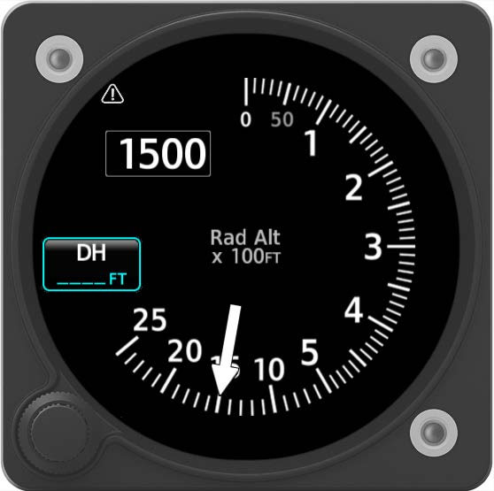
Radar Altimeter
A radio altimeter, or radar altimeter, is used to measure the distance from the aircraft to the terrain directly beneath it. It is used primarily during instrument approaches and supplies the automatic flight system with data to allow for automatic landings when used in association with the ILS. It is also crucial component of the Ground Proximity Warning System (GPWS), providing it with altitude data.
Range and Accuracy
A radar altimeter can be used from the surface up to 2,500 feet AGL with an overall expected accuracy of ± 3% of indicated height or ± 1ft, whichever is greater.
Aircraft Installation
Radar altimeters must show 0 ft AGL when the main wheels touch the runway. However, a single type of radar altimeter may be used in different aircraft, from a Boeing 747 to a small corporate jet, which have very different residual heights. Residual height is the distance between the antenna on the fuselage and the bottom of the trailing wheels on the main landing gear.
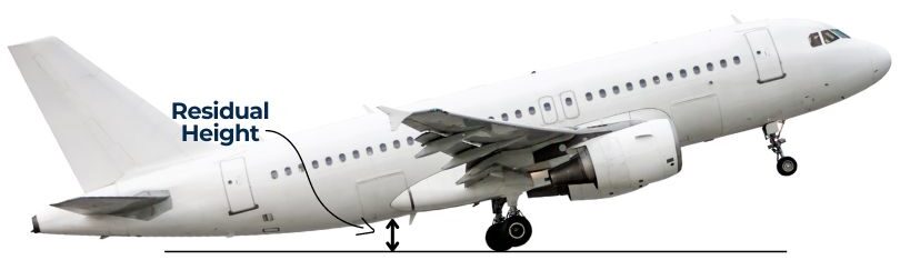
If no compensation is made for residual height, the radar altimeter will not indicate accurately. Additionally, it should be noted that when on the ground, the radio altimeter may show a small negative altitude. The reason for this is that the equipment has been adjusted to indicate zero when the main wheels first touch the runway surface on landing. Therefore when the aircraft is level on the ground the antenna will be below its calibrated position relative to the aircraft landing attitude.