Other Considerations
The minimum IFR altitude is the lowest IFR altitude established for use in a specific airspace. Depending on the airspace concerned, the minimum IFR altitude may be one of the following:

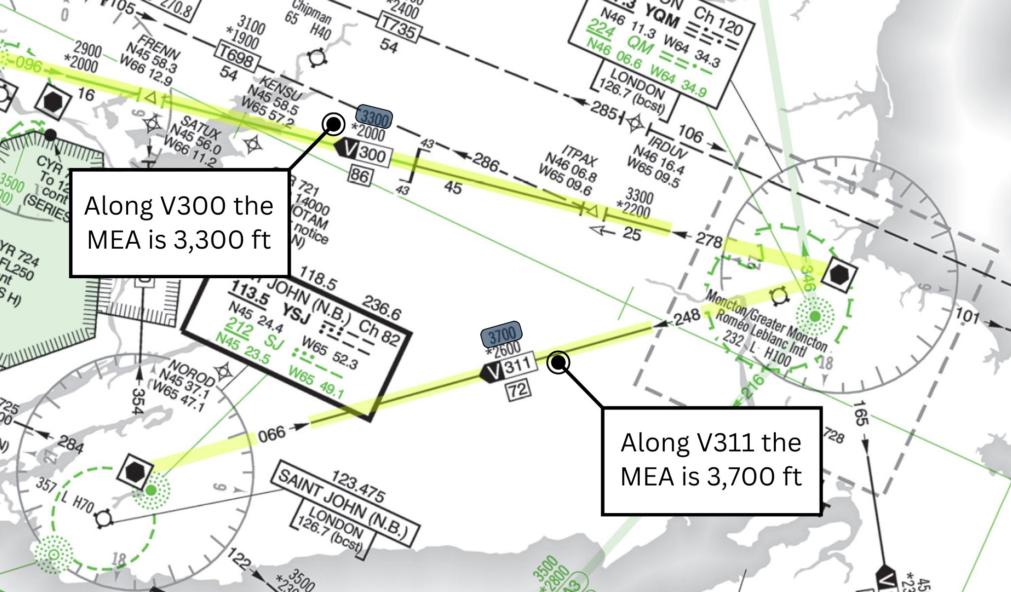
Along Published Airways or Routes
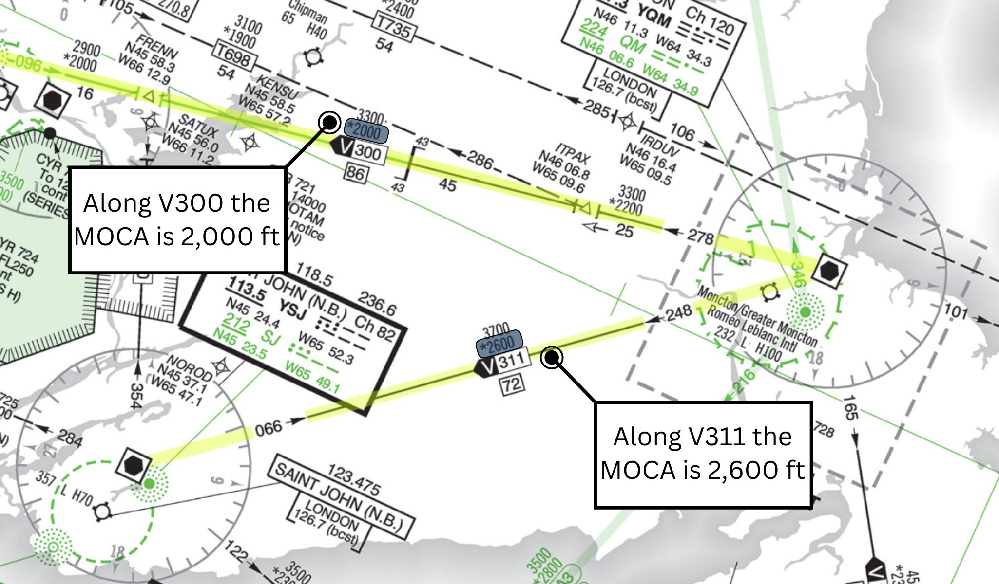
However, obstacle clearance is only a part of the equation. Ensuring that an adequate navigational signal is available from ground-based navaids (e.g. VOR, NDB) is equally important since without it, aircraft dependent on them may be unable to operate in IMC. For this reason, the minimum IFR altitude along published airways is generally the MEA which assures acceptable navigational signal coverage and meets IFR obstacle clearance requirements.
In practice, however, pilots often use GNSS for guidance to navigate along VHF/UHF or LF/MF airways and ground-based NAVAID reception is not an issue. This means that pilots using GNSS for navigation can file or request an altitude below the MEA, but at or above the MOCA, to avoid icing, optimize cruise altitude, or in an emergency. However, an ATS clearance to fly below the MEA could be dependent on issues such as radiocommunication reception and the base of controlled airspace.
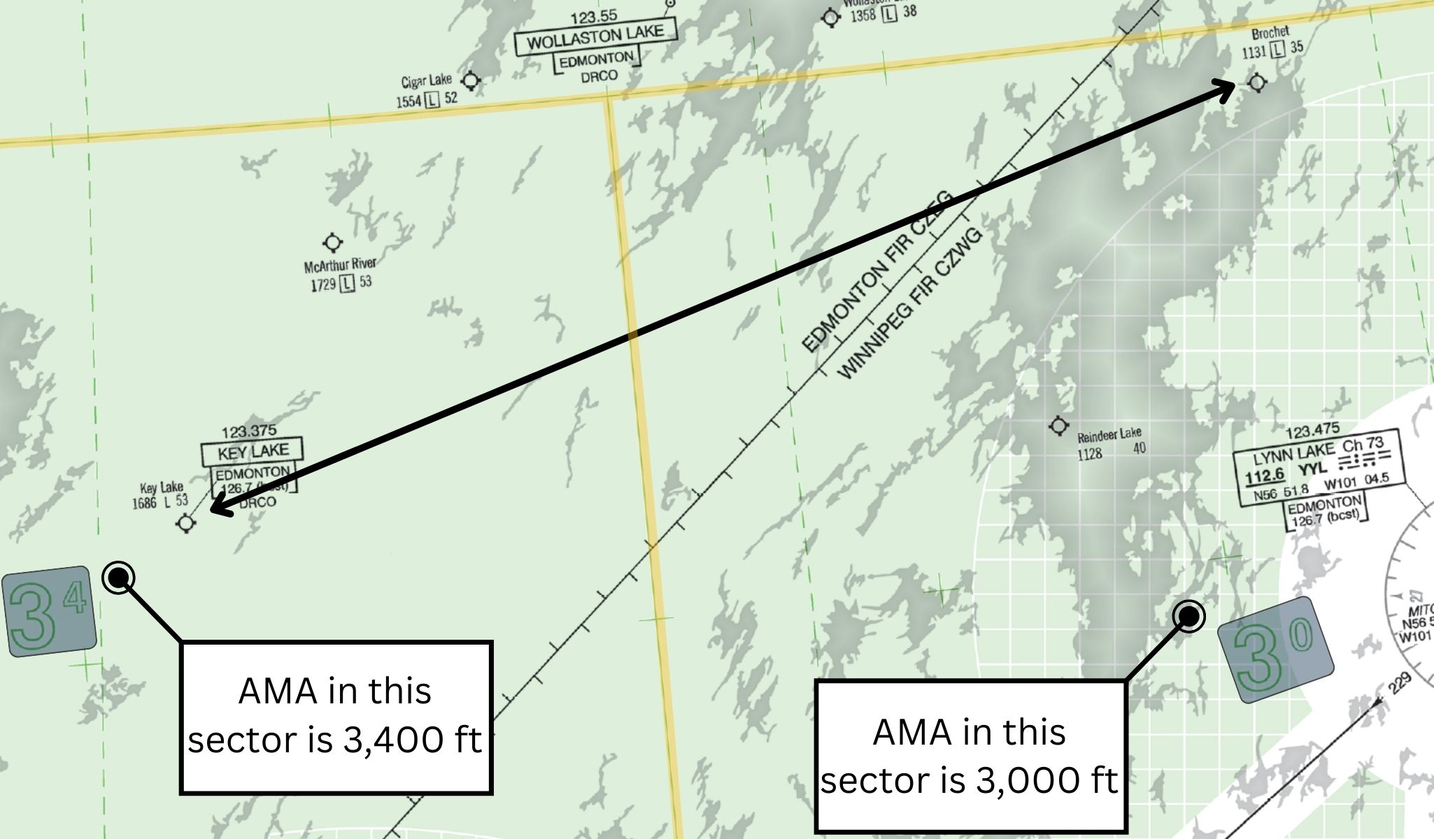
Off Published Airways or Routes
When an aircraft is not operated on an airway or air route, or being operated within airspace in respect of which a minimum altitude has been established, the pilot-in-command must ensure that the aircraft remains at or above an altitude of 1,000 feet above the highest obstacle located within a horizontal distance of five nautical miles from the estimated position of the aircraft.
Note: The required minimum clearance from obstacles increases to 1,500 ft in designated mountainous regions 2,3 and 4 and to 2,000 ft in designated mountainous regions 1 and 5. This will be discussed in more detail in a future lesson.
Filing direct IFR routes is quite common in uncongested areas such as northern Canada which also lacks a well-developed low-level airway structure. These types of routes are generally known as random routes. When filing direct routes or flying off established airways and air routes, the easiest way to ensure obstacle clearance is by flying at or above the Area Minimum Altitude (AMA). It is similar to the Maximum Elevation Figure (MEF) published on VNCs, however, the AMA depicts the lowest altitude that may be used under instrument meteorological conditions and provides a minimum vertical clearance of at least 1,000 ft above all obstacles.
Note: The obstacle clearance is increased to 2,000 ft in designated mountainous areas.
Minimum Sector Altitude (MSA)
The MSA, as depicted on an approach chart provides a 1,000 ft clearance above all obstacles within a sector of a circle having a radius of at least 25 NM centred on a radio aid to navigation or on a waypoint located near the aerodrome. When required, the depiction may be divided into several pie-shaped sectors of varying minimum altitudes. Pilots can locate their sector by superimposing their track to the selected NAVAID onto the MSA depiction.
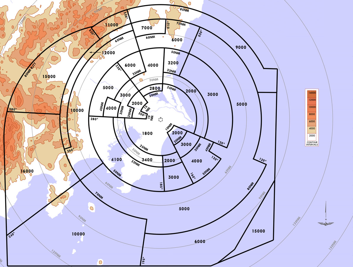
Safe Altitude Within a Radius of 100 NM
The lowest altitude that may be used under instrument meteorological conditions (IMC) that will provide a minimum vertical clearance of 1,000 ft or, in a designated mountainous region, 1,500 ft or 2,000 ft, as appropriate, rounded up to the next 100-ft increment, under conditions of standard temperature and pressure, above all obstacles located in an area contained within a radius of 100 NM of the aerodrome geometric centre.
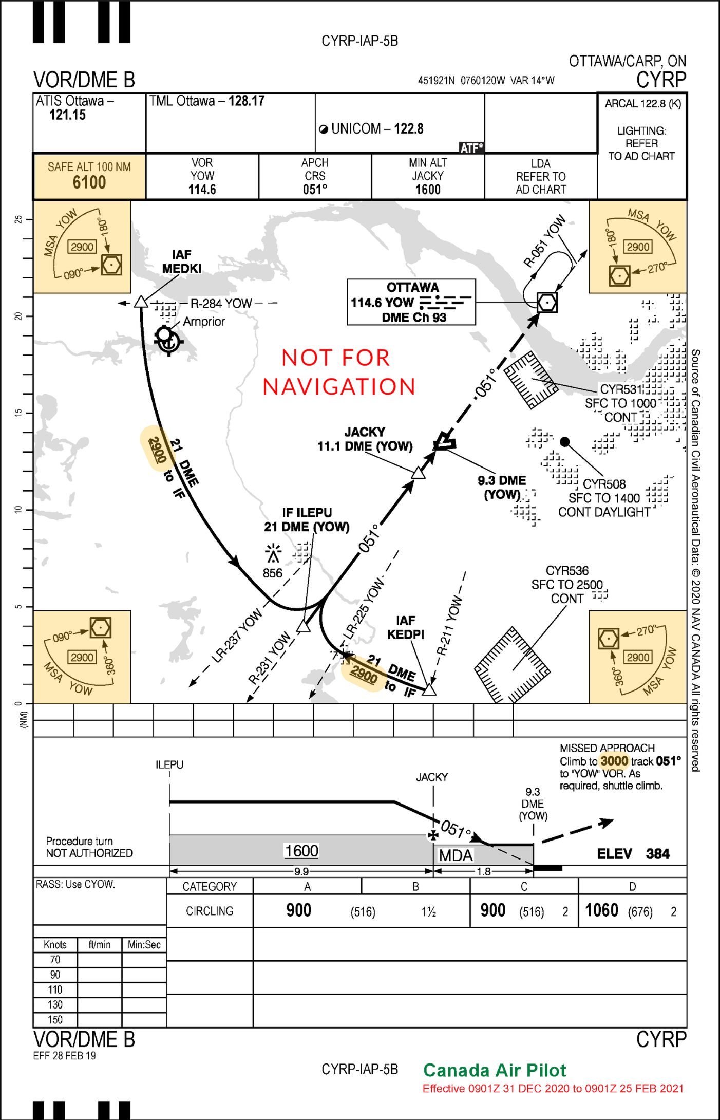
The operational use of the 100 NM safe altitude is relatively straightforward. For example, an aircraft flying a direct route to CYRP, not established on any published airways, and planning to execute the VOR/DME B approach (as shown above), may descend to a minimum altitude of 6,100 feet once it is within 100 NM of the aerodrome’s geographic center. As the aircraft gets closer to CYRP and enters the horizontal dimensions of the Minimum Sector Altitude (MSA), it can descend further to 2,900 feet.
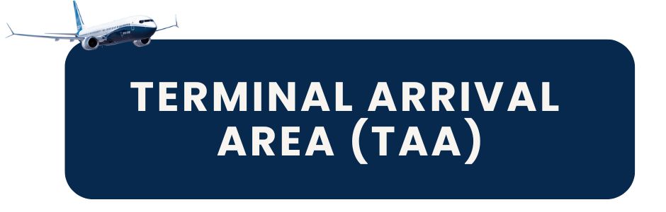
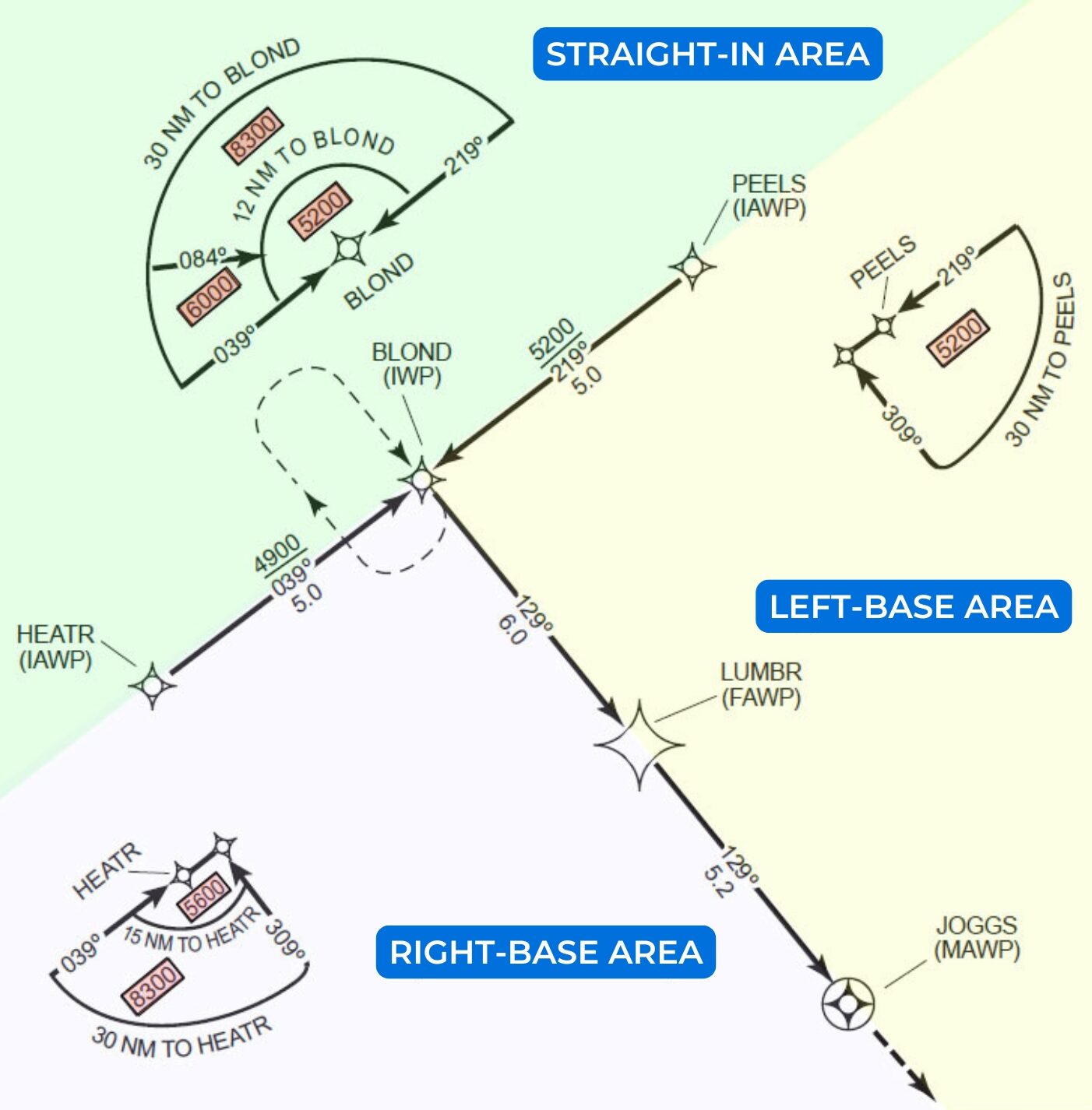
Terminal Arrival Areas (TAA)
TAAs are developed for aircraft equipped with an FMS or a GNSS receiver. When a TAA is published, it replaces the MSA depiction on the approach chart. The main advantage of the TAA over the MSA is that it can allow step-down arcs, based on RNAV distances, within its divided areas. This allows the aircraft to descend to lower minimum altitudes while still providing a minimum clearance of 1,000 ft above all obstacles. The standard TAA consists of three areas which are defined by the extension of the initial and intermediate approach segments. These are called the straight-in, left-base, and right-base areas.
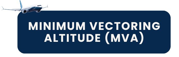
Minimum Vectoring Altitude (MVA)
Minimum Vectoring Altitudes (MVA) are established at several locations to facilitate transitions to instrument approach aids. Generally, the pilot of an IFR flight is responsible for ensuring that the aircraft is operated with adequate clearance from obstacles and terrain. However, when the flight is being vectored, ATC will ensure that the appropriate obstacle clearance is provided.
The MVA is the lowest altitude for vectoring aircraft by ATC that meets obstacle clearance and radio coverage requirements in the airspace specified and may be lower than the minimum altitudes shown on navigation and approach charts.
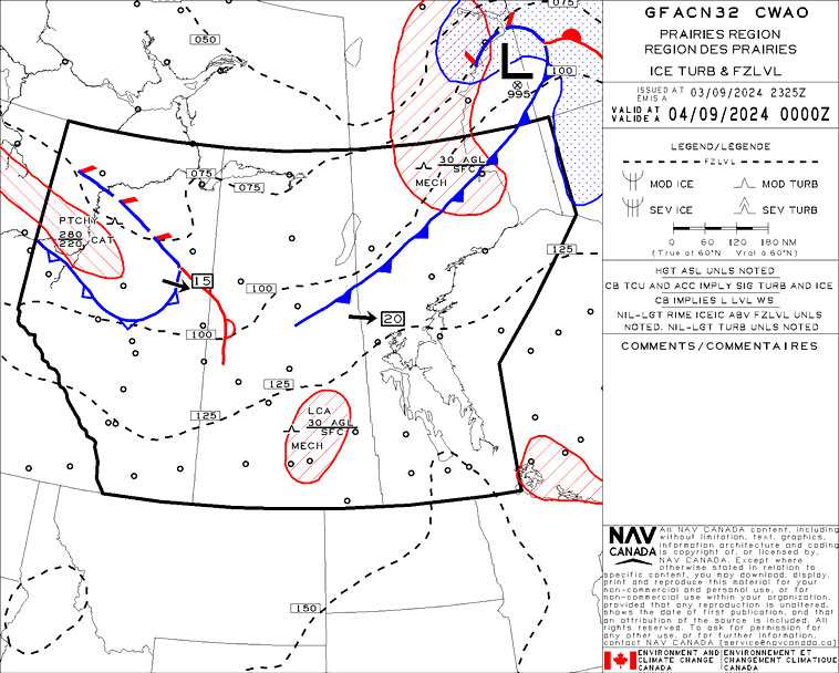
When selecting a cruise altitude for an IFR flight, pilots must evaluate weather conditions with the same diligence as they would for a VFR flight, with particular focus on the freezing level, and areas of potential icing and turbulence. The freezing level is the altitude at which the temperature drops to 0°C. Flying above the freezing level in visible moisture (such as clouds or precipitation) can lead to ice accumulation on the aircraft, which can degrade performance, increase drag, and reduce lift. Pilots should aim to fly below the freezing level where temperatures are warmer to avoid icing conditions unless the skies are clear or the aircraft is certified for flight into known icing conditions. If icing cannot be avoided, pilots need to be aware of their aircraft’s anti-icing capabilities and may need to adjust their altitude accordingly.
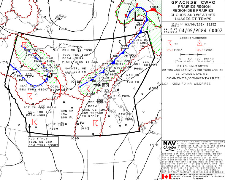
Turbulence is another critical factor to consider when selecting an altitude. Pilots should review turbulence forecasts and reports to identify areas where turbulence is expected along their route. Choosing an altitude that avoids these areas can help ensure a smoother flight. By monitoring weather reports, such as SIGMETs and PIREPs and GFAs, pilots can make informed decisions about the safest and most comfortable cruising altitude for their IFR flight.
When selecting a cruising altitude, pilots must consider several key factors related to aircraft performance. Higher altitudes generally provide better fuel efficiency and higher true airspeed due to lower air density. However, this also reduces engine performance and climb rate, especially in non-turbocharged aircraft. Pilots should be mindful of the aircraft’s service ceiling, particularly when operating near maximum takeoff weight and adjust altitude accordingly to ensure safe and efficient operation throughout the flight.